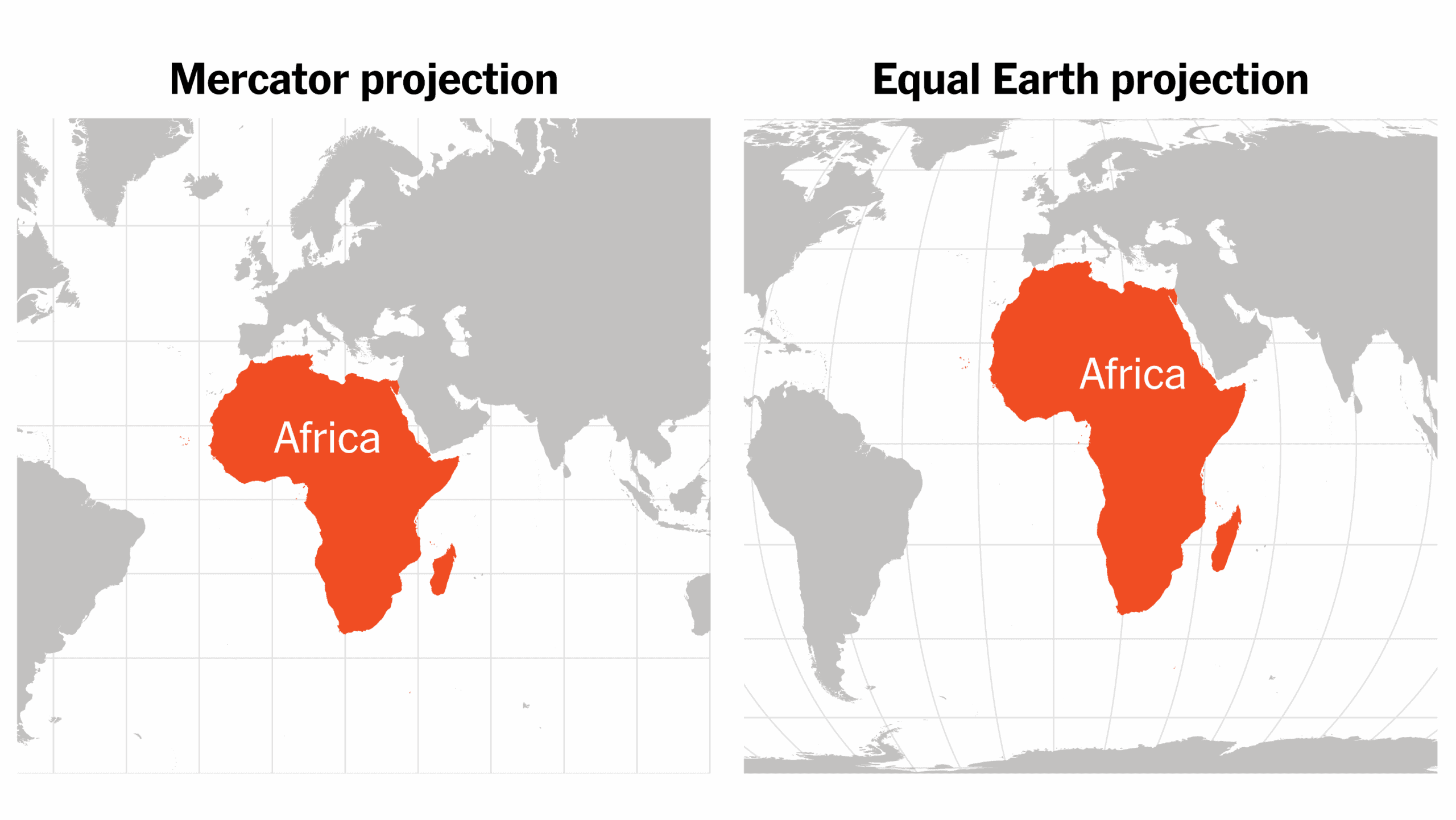
The United Nations has adopted a resolution calling for greater use of the Equal Earth world map, which represents the size and area of countries more accurately, especially in showing Africa’s true geographical scale. The resolution received overwhelming support, with 164 of the 165 countries that voted supporting it. The United States was the only country to vote against the resolution. The Equal Earth projection was developed to reduce the size distortion seen in some traditional world maps. On commonly used Mercator-style maps, countries and regions closer to the poles can appear much larger than they actually are. Africa, for example, can look smaller compared with North America and Europe than its real land area suggests. The move is aimed at promoting a more accurate and balanced visual representation of the world, particularly for education, geography and public awareness.